In the video “Smart Drones for Large-Scale Surveying,” Explified dives into how drones powered by LiDAR, AI, and advanced sensing technologies are transforming surveying workflows across industries. These intelligent aerial systems enable high-precision mapping, reduce manual labor, and offer novel capabilities in complex terrains.
In this blog post, we’ll unpack everything shown in the video—technology, process, applications, challenges, and future outlook—all in a clean, SEO-friendly format. Let’s get started.
What Are Smart Drones & Why They Matter
Smart drones, in this context, refer to unmanned aerial vehicles (UAVs) equipped with advanced sensors (e.g. LiDAR), onboard processing, AI/ML algorithms, and autonomous flight capabilities. Instead of simply capturing images, they can perform:
-
3D point cloud generation
-
Terrain modeling
-
Obstacle detection and avoidance
-
Autonomous navigation over complex terrain
-
Data fusion from multiple sensors
These capabilities allow them to carry out large-scale surveying tasks with higher accuracy, speed, and flexibility compared to traditional ground-based or manned methods.
The video emphasizes how combining LiDAR and AI is a game changer in surveying — enabling drone missions in challenging environments while delivering rich spatial datasets. YouTube
Key Components & Technologies Explained in the Video
Here are the major technological elements and workflow layers highlighted:
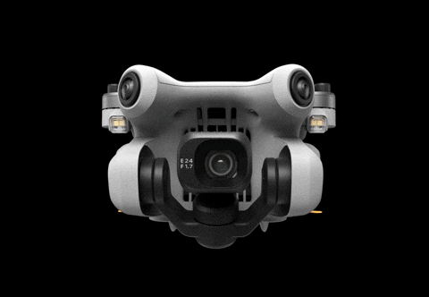
LiDAR Sensors & 3D Point Clouds
-
Drones carry LiDAR (Light Detection and Ranging) units that emit laser pulses, measure their return times, and build dense 3D point clouds of terrain and structures.
-
This produces high-fidelity orthomosaics, elevation models, and structural detail even in dense vegetation or complex surfaces.
Sensor Fusion & Multi-Modal Data
-
Combining LiDAR with RGB cameras or multispectral/thermal sensors helps enrich the data — e.g., overlaying color or thermal information onto the 3D models.
-
This fusion allows you to detect not just shape but features (e.g. material, heat anomalies, vegetation health).
Autonomous Flight & Path Planning
-
Smart drones can autonomously plan flight paths optimized for coverage, overlap, obstacle avoidance, and efficiency.
-
They dynamically adjust altitude, speed, and trajectory based on terrain, sensor data, or obstacles.
-
In the video, Explified shows how these systems adapt to variation in terrain and environment automatically. YouTube
Data Processing & Reconstruction
-
Once the drone completes its mission, collected raw data (LiDAR returns, images) are processed with point cloud software, SLAM (Simultaneous Localization and Mapping), or photogrammetry tools.
-
Algorithms convert data into mesh models, digital elevation models (DEMs), digital surface models (DSMs), and orthophotos.
-
Advanced filtering, noise removal, and classification separate ground, structures, vegetation, and artifacts.
Applications & Use Cases Covered
The video covers several key sectors and use cases where smart drone surveying is especially beneficial:
-
Construction & Infrastructure Projects
For large sites (roads, bridges, pipelines), drones map terrain changes, monitor progress, detect deviations, and assist in site planning. -
Mining & Earthworks
Drones help in volumetric measurements (cut / fill), slope analysis, pit monitoring, and safety surveys. -
Agriculture & Forestry
Surveying large agricultural fields, forests, and plantations for health analysis, terrain mapping, biomass estimation. -
Urban & Land Surveying
In cities, drones map built environments, topography, and urban features. They are useful for cadastral surveys and urban planning. -
Disaster Assessment & Environmental Monitoring
Drones can rapidly survey damage zones, landslides, flood areas, and remote terrain to guide relief or restoration efforts.
Explified emphasizes that in all these contexts, drones provide speed, coverage, and data richness that is difficult to match with traditional methods. YouTube
Challenges, Limitations & Best Practices
The video doesn’t gloss over the complexities. Here are the key hurdles and recommended practices:
Challenges & Limitations
-
Complex Terrain & Vegetation
Dense foliage, steep cliffs, or occluded areas pose difficulties for LiDAR returns and path planning. -
Sensor & Calibration Errors
Misalignments, drift, or noise in sensors lead to artifacts or inaccuracies in the model. -
Regulatory & Safety Constraints
Airspace rules, flight permissions, no-fly zones, and safety restrictions limit drone operations in many regions. -
Computational Load & Data Volumes
Large datasets, heavy point clouds, and processing demands require powerful hardware and efficient algorithms. -
Integration & Workflow Complexity
Connecting autonomous flight, sensor fusion, data processing, and delivery pipelines can be technically demanding.
Best Practices & Mitigations
-
Pre-mission planning: simulate flight paths, test coverage and overlap
-
Redundant data capture: multiple passes, overlapping scans
-
Calibration routines, ground control points (GCPs) for accuracy
-
Use of hybrid sensors (LiDAR + RGB) to fill gaps
-
Use incremental or modular processing to manage data loads
-
Human review and QC steps in the workflow
-
Permissions, safety checks, and compliance with local aviation rules
Implementation Workflow (Step-by-Step)
Here’s how the video suggests converting concepts into a real surveying workflow:
-
Mission Planning
Define the survey area, resolution goal, altitude, overlap, and sensor parameters. -
Pre-Flight Checks & Calibration
Calibrate LiDAR, cameras, GPS, check battery levels, weather, no-fly zones. -
Autonomous Flight Execution
Drone flies the path, dynamically adjusts for obstacles, altitude, and sensor capture. -
Data Capture
LiDAR returns, images, metadata, positional logs. -
Data Ingestion & Processing
Import into point cloud and photogrammetry software, filter noise, register scans, align sensors. -
Model Generation & Classification
Generate DEM, DSM, orthophotos, and classify points (ground, vegetation, structure). -
Analysis & Deliverables
Extract elevation profiles, cross-sections, volumetric reports, change detection, site plans. -
Quality Control & Validation
Compare against ground control points (GCPs), check residuals, assess accuracy. -
Feedback & Iteration
Use results to adjust future missions, refine path planning, sensor settings, and processing parameters.
Advantages & Strategic Impact
Here’s what makes smart drone surveying compelling (as explained):
-
Speed & Efficiency – Cover vast terrain far faster than ground crews
-
Safety – Reduced human exposure in hazardous terrain
-
High Resolution & Detail – Captures fine structure and elevation data
-
Cost Savings Over Time – After setup, lower marginal cost per mission
-
Scalability – Ability to repeat surveys, monitor change over time
For organizations doing repeated or large-area surveying, the strategic gains are enormous.
Future Trends & Outlook
While the video focuses mainly on current state, it hints at where this space is heading:
-
More integration of AI/ML to automatically detect features (roads, buildings, vegetation) from point clouds
-
Edge processing onboard the drone to reduce data transfer and accelerate results
-
Use in GPS-denied or subterranean environments through SLAM-based navigation
-
Swarm drones working collaboratively for massive coverage
-
Real-time monitoring, change detection, and streaming of survey data
As sensor technology improves and costs drop, smart drones become more accessible across industries.